UN
228 Sturry Road
£ 240,000
Description
We don't have a Description for this property.
- Bedrooms
- 2
- Bathrooms
- 0
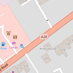
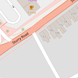

Leaflet © OpenStreetMap contributors
The heatmap indicates the level of crime in the area. The color of the heatmap indicates the crime severity and recency.
Metrics Year-on-Year
- Average area value
- 183,456.00 £Increased by 10.92 %
- Average area rental value
- 818.00 £/moDecreased by 2.27 %
- Est rental Yield
- 5.35 %Decreased by 11.86 %
- Crime Rate
- 29.00 %Unchanged by 0.00 %
from 165,395.00 £
from 837.00 £/mo
from 6.07 %
from 29.00 %
Nearby Schools
| Name | Type | Ofsted | Distance |
|---|---|---|---|
| Parkside Community Primary School | Community School | Requires improvement | 0.61 KM |
| Canterbury Christ Church University | Higher Education Institutions | 1.74 KM | |
| Barton Court Grammar School | Academy Converter | Good | 1.85 KM |
| St Thomas' Catholic Primary School, Canterbury | Voluntary Aided School | Outstanding | 1.85 KM |
| Riverside Children'S Centre (Canterbury) | Children's Centre | 1.94 KM |
Images
Nearby Streets
| Name | Average Price | Average Sqft | Distance |
|---|---|---|---|
| Westminster Road | £ 0 | 0 | 0.00 KM |
| Chaucer Road | £ 0 | 0 | 0.00 KM |
| Blenheim Avenue | £ 255,000 | 0 | 0.00 KM |
| Cavalry Close | £ 350,000 | 0 | 0.00 KM |
| Riverside | £ 121,250 | 0 | 0.00 KM |
Nearby Transport
| Name | NLC | TLC | Distance |
|---|---|---|---|
| Sturry | 5029 | STU | 2.65 KM |
| Canterbury West | 5007 | CBW | 2.90 KM |
| Canterbury East | 5164 | CBE | 3.28 KM |
| Bekesbourne | 5198 | BKS | 5.12 KM |
| Herne Bay | 5174 | HNB | 8.47 KM |
Nearby Listings
| Address | Price | Type | Score | Distance |
|---|---|---|---|---|
| Sturry Road, Canterbury, CT1 | £ 300,000 | BUY | Unknown | 0.08 KM |
| East Street, Canterbury, Kent, CT1 | £ 280,000 | BUY | Unknown | 0.17 KM |
| Sturry Road, Canterbury, Kent, CT1 | £ 230,000 | BUY | 5 / 10 | 0.23 KM |
| Vauxhall Avenue, Canterbury, Kent | £ 240,000 | BUY | 5 / 10 | 0.28 KM |
| Vauxhall Avenue, Canterbury, Kent, CT1 | £ 260,000 | BUY | 7 / 10 | 0.29 KM |
Nearby Properties
| Address | Price | Distance |
|---|---|---|
| 236 Sturry Road | £ 270,000 | 0.00 KM |
| 196 Sturry Road | £ 190,000 | 0.00 KM |
| 208 Sturry Road | £ 195,000 | 0.00 KM |
| 212 Sturry Road | £ 177,000 | 0.00 KM |
| 192 Sturry Road | £ 140,000 | 0.00 KM |